River Minho
Image by vjgalaxy

The river Minho
The river
Located in the northwest of the Iberian Peninsula, it is, without a doubt,theriver the most important and abundant in Galicia and one of the main in the peninsula.
Known as "father of the Galician rivers", it has its source in el Irimia Scree (periglacial-type block flow), at an altitude of about 695 meters above sea level, on the western slope of the Serra de Meira (Cantabrian mountain range), at the foot of the Pico do Forno de Martín ( 892 masl) (Meira-Lugo).
Throughout his approximately318 km of main channel, and heading NE-SW, it crosses the provinces of Lugo, Ourense and Pontevedra and,in its last 78 km, it acts as a natural and administrative border between Spain and Portugal. At its mouth in the Atlantic Ocean it forms aestuary of 22 km2 and 40 km long, navigable the last 33 km, of great ecological, economic and social importance.

Perfil topográfico rio Miño/Minho

Pedregal de Irimia (Meira, Lugo)

Estuario/Foz rio Miño/Minho
Perfil topográfico rio Miño/Minho
Its most important tributary is the Sil river, with 241 km long, whose confluence occurs in Os Peares (Lugo), and which provides it with almost twice the amount of water that the Miño brings at that point. In addition, from its source, on the right, it receives water from the Ladra, Avia, Tea and Louro rivers; and to the left of the Neira, Arnoia, Mouro and Coura rivers, among others.
obstacles
In the hydrographic basin there are71 large hydraulic infrastructures. Along the main channel of the Miño are located 5 large dams and reservoirs. The first since its birth, is the dam ofbelesar(Chantada-Lugo), completed in 1963, it is 132 meters high and its reservoir is approximately 50 km long. Followed The Pears(Panton-Lugo),velle(Ourense-Ourense),Castrelo de Miño(Ribadavia-Ourense), and, lastly, Frieira (Crecente-Pontevedra) being thisthe first big obstacle in the way of migratory fish. The Sil River is also highly affected by the construction of dams, with up to 13 large infrastructures in its main channel of Barcena (Ponferrada-Leon).
The largest reservoir of all is Belesar (1,828 ha), followed by As Portas (Vilariño de Conso-Ourense, con 1,183 ha) and Bárcena (986 ha). By dam height, the largest are As Portas (141 m) and Belesar (132 m).
Also,in the international hydrographic basin of the Miño River (CHIRM), 387 obstacles are inventoriedof small or medium size (< 10 m high), of which 90 are located in the Spanish part and 297 in the Portuguese part. Of these, 55 are considered difficult or impassable obstacles for migratory species.
Sources:


The International Minho
Since the year 1864(Treaty of Limits, signed in Lisbon on September 29),the last 77.8 km of the Miño River act as a wet, physical and administrative border, between Spain and Portugal, from the confluence of the Troncoso or Barxas River (also border) to the mouth of the Atlantic Ocean, between the towns of Caminha (Pt) and A Guarda (Es). It is called the International Section of the Miño River (TIRM).
Article I. The line of separation between the Sovereignty of the kingdom of Spain and that of the kingdom of Portugal from the mouth of the Miño river, between the Spanish province_cc781905-5cde- 3194-bb3b-136bad5cf58d_of Pontevedra and the Portuguese district of Viana do Castelo, it will go through the center of the main current of the Miño to the confluence of the river Barjas or Troncoso. The Canosa Island, located near the mouth of the Mino, the so-called Cancela, the Insula Grande, which is found in the Verdoejo group of islands, between the Spanish people Caldelas and the Portuguese Verdoejo, and the Filla Boa islet, located near Salvatierra, will belong to Spain. The islands called Canguedo and Rana Gallega, which are part of the aforementioned group of Verdoejo, will belong to Portugal.
.....
Annex I, Article II. By virtue of the common use that on the bordering rivers corresponds tothe peoples of both nations, will be able to navigate freely on the Mino, [...] Likewise, the inhabitants of both territories may pass from one to the other orilla with all kinds of boats, and take advantage of the waters for all the uses that suit them, provided that in said cases do not violate the existing public agreements or the customs received between the peoples of both banks, nor alter in the least the conditions of the rivers for common and public use.
The hydrographic basin that drains into the international stretch of the Miño River (CHIRM) covers 1,918 km2, being 11.3% of the total area of the basin. Administratively it covers the Galician provinces of Ourense and Pontevedra and the district of Viana do Castelo in the Portuguese part. In Spain, it covers 26 councils, and in Portugal 9 chambers.
Of the total of the CHIRM, the Spanish part (CHIRM-ES) occupies 1,110 km2 and the Portuguese part (CHIRM-PT) 809 km2.

The question of the islands
On the international section a valley is formed that widens, gradually decreasing the speed of the water and allowing a greater deposition of materials due to natural alterations in the course of the river (seasonal variations) or due to human influence (reservoir construction since the 1960s limited flood peaks and increased sedimentation, as well as the existence of pesqueiras, which also affect sedimentary dynamics).
This sedimentation allows the formation of sandbanks or alluvial islands: las morraceiras, insuas or mouchões, typical of the lower section, although there are also granite rocky islands, more typical of the upper section (upstream of Monção). These processes are very dynamic, the islands can form in days or years, and then disappear, move or consolidate and be colonized by vegetation. Famous are those ofCanosa, Morraceira do Grilo, Boega or the Verdoejo complex. These islands are areas of great ecological interest.
The issue of the nationality of the islands is very complex (even toponymy)due to its own creation/disappearance dynamic.The only existing document signed by both countries is el Treaty of Limits of 1864, and its annexes of 1866, which delimited the fluvial border and, in its article I (cited above), determined the nationality of the following islands:
-
Spanish Islands:
-
Canosa (there is evidence since 1691)
-
Cancela (or Caldelas, exists constancia since 1683, unknown to which it refers)
-
Ínsua Grande (grupo de Verdoejo, no longer exists as an island, it has joined the mainland)
-
Philaboa
-
-
Portuguese islands
-
Canguedo (Verdoejo group)
-
Galician Raña (now part of the island of Canguedo)
-
Since this is the only official document,the rest of the islands that do not appear in the treaty are assumed to be international, or rather, without nationality, not being disputed by either country until their nationality is decided by the International Boundary Commission.


Big Island
Canguedo
Galician Frog
Plan of the Partido de Tuy that shows the dividing line between Spain and Portugal with the Customs and Contra-registries located on the borders of both Kingdoms, made by Juan Quintana [in scale ca. 1:92,000]. Dated in A Coruña in 1807
Source: AHN, Department of Foreign Affairs, Maps and Plans, 1138. Extracted from Garcia, J & Puente, P. (2015)
Detail of the section corresponding to the islands of Verdoejo, north of the Portuguese village of the same name (Berdoexo in the plane). The letters indicated on the map represent: A: Ínsula Grande; B: Canguedo; C: Galician Frog; a: Portuguese salt warehouses; b: isolated houses; c: fisheries; and: portions of land reclaimed from the river with the construction of fisheries.
Source: AHN, Department of Foreign Affairs, Maps and Plans, 1138. Extracted from Garcia, J & Puente, P. (2015)
Today, the situation of the islands is obviously very different from that time. Basándose en fotointerpretación de ortofotos y de imágenes satelitales (históricas y de máxima actualidad) se ha realizado un inventario aproximado de_cc781905-5cde-3194- bb3b-136bad5cf58d_the existing islands in the TIRM, considering these as permanently emerged land and surrounded by water (in normal flow regimes) and that has consolidated vegetation. Small rocky outcrops have been neglected. The most important ones are:
Orthophoto comparators (1956-2017):
The use of the international islands is also regulated, especially hunting, being their surveillance the responsibility of la Capitania do Porto de Caminha(National Maritime Authority) and the Naval Command of the Miño (Spanish Army).
The island ofSaint Isidro, known asinsua, located outside the mouth of the Miño, next to Moledo beach (Caminha) belongs to Portugal. It is a granite island, with no geomorphological relationship with the previous ones. It is located el Forte da InsuaeitherFort of Nossa Senhora da Ínsua, 17th century fortification classified as a National Monument.
Sourceen:
-
Cairo, H. & Godinho, P. (2014).The Lisbon Treaty of 1864: the demarcation of the border and national identifications. History and Politics magazine, no. 30, Madrid, July-December (2013), pp. 23-54, ISSN: 1575-0361
-
García, J & Puyo, J. (2015). The geographical and cartographic contribution of the Luso-Franco-Spanish Boundary Commissions (18th and 19th centuries). Terra Brasilis (Nova Série) [Online], 6-2015, Published on December 17, 2015. DOI :10.4000/terrabrasilis.1693
-
García, J & Puente, P. (2015). The delimitation of the Portuguese-Spanish border on the Miño River (1855-1906)._CC781905-5CDE-3194-BB3B-13BAD5CF58D_TERRA BRAZILIS (NOVA SERIE) [Online], 6-2015, published on December 17, 2015._CC781905-5CDE-3194-BB3B-13BAD5CF58D_DOI_CC781905-5CDE-31 .1708
-
Garcia, J & Puente, P. (2015).The Mixed Boundary Commissions and the geographical representations of the Spanish-Portuguese border (1855-1906). Magazine of Historiography, nº 23, pp. 67-100..
-
Garcia, J & Puente, P. (2016).The Spanish-Portuguese border on the Miño River in the Limits Treaty of 1864. Demarcation and management of a conflictive fluvial territory.In: Landscape, territorial culture and experience of Geography. Tribute book to Professor Alfredo Morales Gil. Published in December 2016. ISBN: 978-84-16724-03-1. DOI: 10.14198/LibroHomenajeAlfredoMorales2016-34.
Etymology
Historically, the Miño River has well documented its importance as a mark of the territory it encompasses, as described by authors such as Strabo, Mela, Pliny or Ptolemy.
The etymological originde -Miño- causes discrepancies among researchers. Some authors cite that the origin may come from the Latin termminimum, which means “of the color of minium”, a reddish mineral. This statement comes from the first extant reference made by Marco Juniano Justino, a great historian of the second century of our era. In his work Justini Historiarum Philippicarum Libri XLIV, an anthology of the universal history of antiquity that Trogus Pompey (Galo-Roman historian of the 1st century of our era) had written, which is not preserved, in relation to the territories of thegallaecia,It talks about its mineral wealth and the name it has taken from a river:
Regio (Gallaecia) cum aeris ac plumbi ubérrima stannum & minio quod etiam vicino flumini nomen dedit
One interpretation would be "very abundant [Galicia] both in copper and lead, as well as in red lead, which even gave its name to the neighboring river". This statement is wrong since the valley of the Miño river does not have deposits of red lead and its waters do not have that color. It would be more likely that it referred to the river Sil by an etymology of reference to the Latin termsil, in Greekokhra, that is, ocher (iron oxide), since it can have waters of that color, mainly because important gold explorations are located in its basin.
Most likely, as other authors affirm, the origin of -Miño- is in theindo-european root *mein-“walk, march, flow” or have a relationship withpre-Indo-European hydronymsWhat*men-iyo-“mountain” for what would be the “mountainous” river, very much in keeping with the Galician topography.
Sources:
-
Moralejo Alvarez, J.,2009.MINIUS/MINHO/MINO. Minius (17), 17-23
-
Bascuas López, E., 2008.The hydronymy of Galicia. Three strata: paleoeuropean, celtic and latin. (C. d. Mondoñedo-Ferrol, Ed.) Mindonian Studies(24)
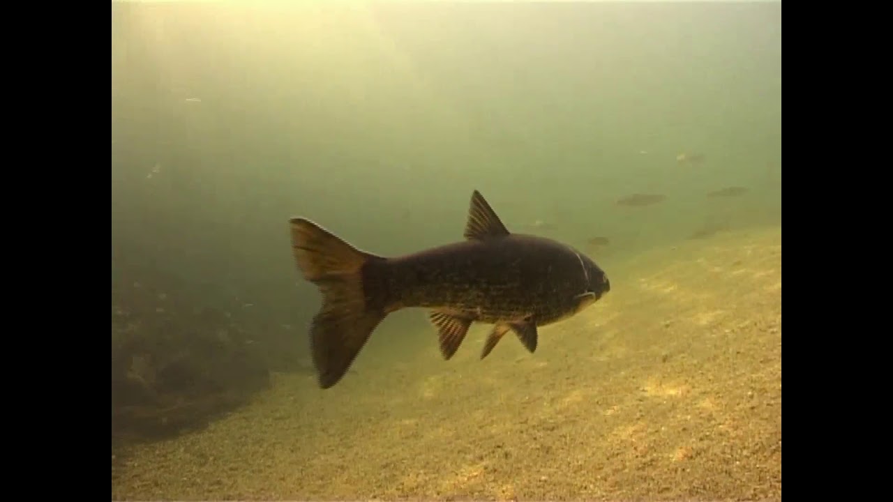
Life on the Miño River (video)